
What is looking like the storm of the season is about to push into the Alps. The most affected area is expected to be south of the main Alpine Ridge (Italy's Aosta valley and Monterosa) but it will spill over into both France (Tarentaise and south) and Switzerland's Valais.
Many ski areas are now closed, of course, but open resorts likely to pick up a lot of snow over the next few days include Tignes, Verbier and Zermatt - so some good options if you can get there.
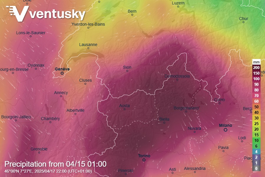
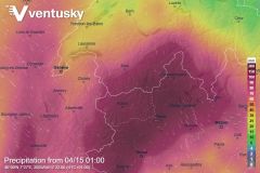
This graphic from Ventusky shows the expected precipitation, according to the ICON forecast model, over the next 48 hours.
Yes, that's up to 200mm of rain... potentially 2 metres of snow.
There is some variation in the forecasts; with ICON and ECMWF going for around 1.5 metres of snow, and GFS piling more on top of that.
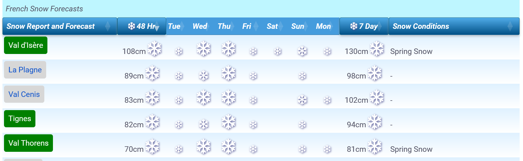
French Snow forecasts - predictions from ICON
The key unknown, until it happens, is the evolution of the snow line. It will start high, above 2500m for the start of the storm (tonight, Tuesday 15th) but is likely to drop as low as 1500m by Friday morning - depending on location.
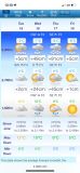
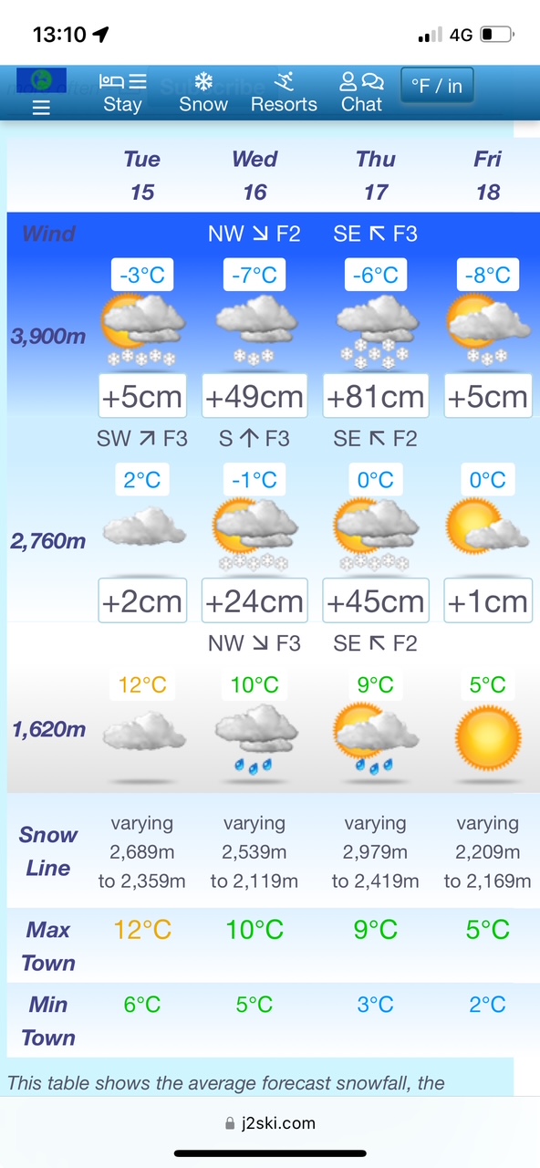
This is what we see for Zermatt for the rest of the week;
If you're traveling in the affected area on Wednesday or Thursday you should keep an eye on local forecasts and road conditions as there will be torrential downpours at times with the likelihood of flooding in susceptible valleys and disruption to road and rail routes.
Expect lift closures during and after the storm, for slopes to be made safe.
For skiing at the weekend (Easter), expect conditions on piste to be epic and off piste to be dangerous (at first, at least)! Avalanche Danger will be extreme once the storm blows through so give things time to stabilise and make sure you understand the local, on-the-spot, avalanche risk before you ski.
Please take care; it will be huge fun on the marked, open runs after the storm but there will be avalanches this weekend - probably some big ones.
If you're lucky enough to be out there, stay safe and send us some pictures...